Hi, my name is Bi Deng. I am a doctoral student at Claremont Graduate University (CGU) studying Organizational Behavior with a co-concentration in Evaluation. Back in 2009, I attended a CGU workshop by our GIS specialist Warren Roberts and was blown away by the utility of GIS in social science research, particularly for evaluation projects. I’ll be talking about how GIS can help us answer a wide range of place-, space-, and time-oriented questions (Meeks, 2008).
What is GIS? A geographic information system (GIS) captures, stores, analyzes, manages, shares, and presents data that is linked to location, such as people to an address or crime to a demographic area. GIS allows us to view, interpret, and visualize data in ways that reveal relationships, patterns, and trends in the form of maps, globes, reports, and charts (ESRI.com).
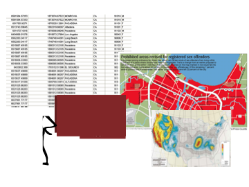
Why use GIS? If you were to look at a tabular set of data, it is not easy to interpret or see a pattern in a large database. GIS allows you to visualize large amounts of complex, spatial data across layers of various maps. Most problems and issues (e.g., cultural, environmental, economic, political, social) we face today exist in a geographic context (ESRI.com). An estimated 80% of all data held by business and government organizations have a spatial component (Franklin, 1992) – which means most data in can be analyzed “spatially.”
Some of the basic research questions GIS can help us answer include (W. Roberts, personal communication, January 23, 2009):
- Location: What is at…?
- Trends: What has changed…?
- Condition: Where is the location that meets these criteria?
- Pattern: What is the spatial pattern or distribution…?
- Modeling: What if…?
For example, when doing spatial analysis, you can run queries to:
- Identify specific features (e.g., what is the income level of a particular region that your client is serving)
- Identify features based on conditions (e.g., out of a group of regional sites, you can identify all the high-performing or low-performing sites of your client)
- Interactions (e.g., investigate whether poverty levels of a region affects the participation rates of your client organization)
Rad Resource: If you would like to learn more about GIS, the ESRI website is a great resource. ESRI’s ArcGIS community posts featured maps and applications of GIS. On ArcGIS.com, you can take a quick tutorial and register for a free account to create and share an interactive map: http://www.arcgis.com/home/gallery.html
Rad Resource: Want to explore what kinds of free data there is for researchers? Check out these sites:
Rad Resources:
- Franklin, C. (1992). An introduction to geographic information systems: Linking maps to databases. Database, 15(2), 17-22.
- Meeks, W. L. (2008). The utility of geospatial data and information used in Geographic Information Systems (GIS): An exploratory study into the factors that contribute to geospatial information utility. Unpublished doctoral dissertation, George Washington University, Washington, DC.
Cool Trick: Want to see a neat example of GIS in action? Check out Recovery.com – this site uses GIS to track and display data related to how funds of the Recovery Act is being awarded and spent. You can check to see how $275 billion of federal funds made available for federal contracts, grants, and loans are being used in your own community. http://www.recovery.gov/Pages/home.aspx
This contribution is from the aea365 Daily Tips blog, by and for evaluators, from the American Evaluation Association. Please consider contributing – send a note of interest to aea365@eval.org.


GIS establishes and maintains an automated one to one link between any given feature location and its descriptive attributes. GIS allows us to view, interpret, and visualize data in ways that reveal relationships, patterns.
One more “Rad Resource” – http://www.landpoint.net/overlooked-benefits-of-gis-and-land-surveying/
Another “Rad Resource” — The CDC’s free EpiInfo software includes a GIS application, EpiMap. It’s not nearly as fully-featured or powerful as ArcMap, but for the price it’s hard to beat.
http://www.cdc.gov/epiinfo/
Did I mention it’s free? 🙂